CoastalErosionProfile Node
Applies a coastal erosion profile to a terrain elevation field, carving a shoreline shape using ground- and water-distance transforms and optional post-filtering.
Category
Erosion/Water
Inputs
| Name | Type | Description |
|---|---|---|
| elevation_in | VirtualArray | Input terrain elevation to which the coastal profile will be applied. |
| mask | VirtualArray | Optional mask defining where the coastal transformation is allowed to operate. |
| noise | VirtualArray | No description |
| water_depth_in | VirtualArray | Input water depth map used to maintain water surface height consistency. |
Outputs
| Name | Type | Description |
|---|---|---|
| elevation | VirtualArray | Output modified terrain elevation after applying the coastal erosion profile. |
| scarp_mask | VirtualArray | No description |
| shore_mask | VirtualArray | Output mask (values in [0,1]) indicating the shoreline region influenced by the coastal transformation. |
| water_depth | VirtualArray | Output water depth map representing flooded areas. |
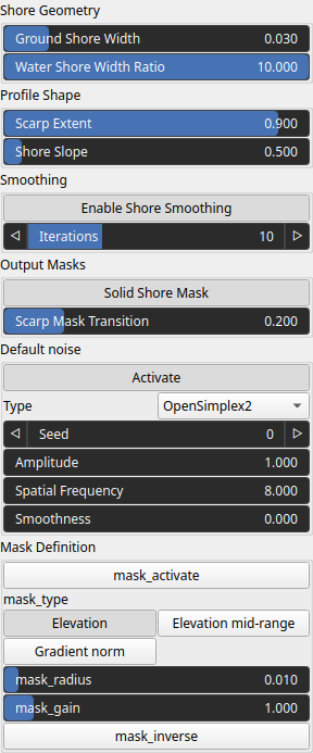
Parameters
| Name | Type | Description |
|---|---|---|
| Enable Shore Smoothing | Bool | If true, applies Laplacian smoothing restricted to the shoreline region after the coastal profile is applied. |
| Activate | Bool | Enables or disables the built-in drainage noise. If an external noise input is provided, it overrides this default noise. |
| Spatial Frequency | Float | Base spatial frequencies in the X and Y directions. |
| Amplitude | Float | Noise amplitude. |
| Type | Enumeration | Noise type. |
| Seed | Random seed number | Random seed number. The random seed is an offset to the randomized process. A different seed will produce a new result. |
| Smoothness | Float | Controls the resulting smoothness of the fractal layering process. |
| mask_activate | Bool | Enables or disables the internal mask. If the node's 'mask' input is connected, this setting is bypassed and the input mask is used instead. |
| mask_gain | Float | Controls the intensity or influence of the internal mask. Bypassed if the 'mask' input is connected. |
| mask_inverse | Bool | Inverts the internal mask, applying the operator where the mask is low. Ignored if a 'mask' input is provided. |
| mask_radius | Float | Defines the smoothing radius for the internal mask. A value of 0 disables smoothing. This is bypassed if the 'mask' input is used. |
| mask_type | Choice | Specifies how the internal mask is computed: 'Elevation' uses height, 'Gradient Norm' uses slope, and 'Elevation mid-range' selects the middle portion of the height range. This parameter is ignored when a 'mask' input is connected. |
| Iterations | Integer | No description |
| Scarp Extent | Float | Ratio in [0,1] defining how much of the ground-side profile is a vertical scarp instead of a sloped shore. |
| Scarp Mask Transition | Float | No description |
| Ground Shore Width | Float | Horizontal extent over which the ground-side coastal profile is applied, with respect to a unit domain. |
| Water Shore Width Ratio | Float | Ratio controlling how far the underwater slope extends relative to the shore width. |
| Shore Slope | Float | Ground-side slope magnitude of the coastal profile, in elevation units per domain width. |
| Solid Shore Mask | Bool | No description |
Example
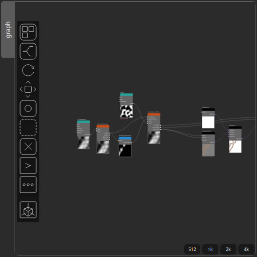
Corresponding Hesiod file: CoastalErosionProfile.hsd. Use [Ctrl+I] in the node editor to import a hsd file within your current project.
Note
Example files are kept up-to-date with the latest version of Hesiod. If you find an error, please open an issue.