WaterDepthFromMask Node
Computes water depth over a terrain using a mask to define flooded regions. The method performs a harmonic interpolation (Laplace equation) over the masked domain using a Successive Over-Relaxation (SOR) solver. The resulting water surface is interpolated from boundary conditions, and the water depth is obtained as the difference between this surface and the terrain elevation.
Category
Hydrology
Inputs
| Name | Type | Description |
|---|---|---|
| elevation | VirtualArray | Input terrain elevation (height field). |
| water_mask | VirtualArray | Input mask defining where water can accumulate. Values above the threshold indicate flooded regions. |
Outputs
| Name | Type | Description |
|---|---|---|
| water_depth | VirtualArray | Output water depth map representing flooded areas. |
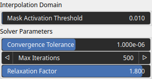
Parameters
| Name | Type | Description |
|---|---|---|
| Max Iterations | Integer | Maximum number of SOR iterations used to solve the harmonic interpolation. |
| Mask Activation Threshold | Float | Threshold used to convert the input mask into a binary field. Values above the threshold define flooded regions, while lower values act as boundaries. |
| Relaxation Factor | Float | Relaxation factor for the SOR solver. Values between 1 and 2 are recommended for faster convergence. |
| Convergence Tolerance | Float | Convergence tolerance. The solver stops when the maximum update between iterations falls below this value. |
Example
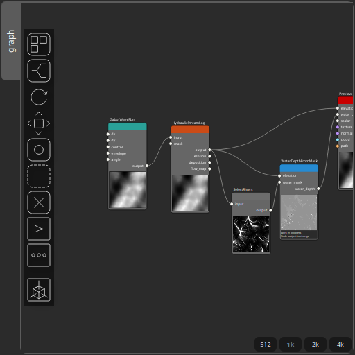
Corresponding Hesiod file: WaterDepthFromMask.hsd. Use [Ctrl+I] in the node editor to import a hsd file within your current project.
Note
Example files are kept up-to-date with the latest version of Hesiod. If you find an error, please open an issue.