ProjectTalus Node
Projects heightmap values along a discrete grid direction using talus-based attenuation. Values propagate outward following the D8 convention and decay with distance according to a talus coefficient. The operation is typically used for slope-dependent diffusion, debris flow approximation, or directional spreading effects.
Category
Filter
Inputs
| Name | Type | Description |
|---|---|---|
| input | VirtualArray | Input heightmap whose values are projected along the selected direction. |
| mask | VirtualArray | Optional mask controlling where the projection effect is applied. |
Outputs
| Name | Type | Description |
|---|---|---|
| output | VirtualArray | Resulting heightmap after directional projection and talus-based attenuation. |
Parameters
| Name | Type | Description |
|---|---|---|
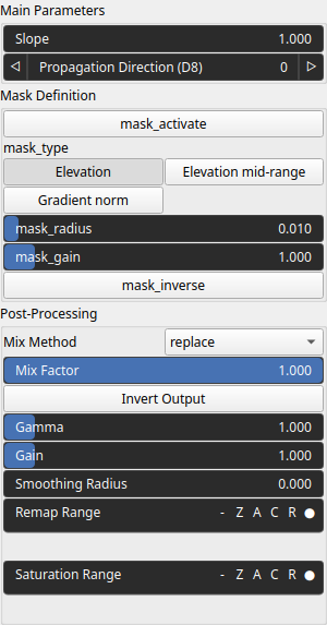
| Propagation Direction (D8) | Integer | Propagation direction following the D8 grid convention. Values range from 0 to 7, each corresponding to one of the eight neighboring directions on a 2D grid. |
| mask_activate | Bool | Enables or disables the internal mask. If the node's 'mask' input is connected, this setting is bypassed and the input mask is used instead. |
| mask_gain | Float | Controls the intensity or influence of the internal mask. Bypassed if the 'mask' input is connected. |
| mask_inverse | Bool | Inverts the internal mask, applying the operator where the mask is low. Ignored if a 'mask' input is provided. |
| mask_radius | Float | Defines the smoothing radius for the internal mask. A value of 0 disables smoothing. This is bypassed if the 'mask' input is used. |
| mask_type | Choice | Specifies how the internal mask is computed: 'Elevation' uses height, 'Gradient Norm' uses slope, and 'Elevation mid-range' selects the middle portion of the height range. This parameter is ignored when a 'mask' input is connected. |
| Gain | Float | Mid-centered gain transformation applied to the elevation values. This is a non-linear recurve operator centered around the mid elevation (typically 0.5). Increasing the gain pushes values toward the minimum and maximum elevations, creating flatter low/high regions with a steeper transition around the midpoint. |
| Gamma | Float | Standard gamma correction applied to the elevation values. This is a monotonic power-law remapping that shifts emphasis toward low or high elevations, making the overall shape sharper or bulkier without changing its ordering. |
| Invert Output | Bool | Inverts the output values after processing, flipping low and high values across the midrange. |
| Mix Factor | Float | Mixing factor for blending input and output values. A value of 0 uses only the input, 1 uses only the output, and intermediate values perform a linear interpolation. |
| Mix Method | Enumeration | Method used to combine input and output values. Options include linear interpolation (default), min, max, smooth min, smooth max, add, and subtract. |
| Remap Range | Value range | Linearly remaps the output values to a specified target range (default is [0, 1]). |
| Saturation Range | Value range | Modifies the amplitude of elevations by first clamping them to a given interval and then scaling them so that the restricted interval matches the original input range. This enhances contrast in elevation variations while maintaining overall structure. |
| Smoothing Radius | Float | Defines the radius for post-processing smoothing, determining the size of the neighborhood used to average local values and reduce high-frequency detail. A radius of 0 disables smoothing. |
| Slope | Float | Talus attenuation coefficient controlling how quickly projected values decay with distance along the propagation direction. Higher values result in shorter propagation ranges. |
Example
No example yet
No example available for this node.